


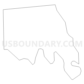
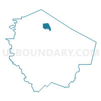
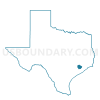
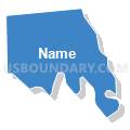
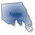
Voting District 3095, Fort Bend County, Texas
About
Outline
Summary
| Unique Area Identifier | 673166 |
| Name | Voting District 3095 |
| County | Fort Bend County |
| State | Texas |
| Area (square miles) | 6.52 |
| Land Area (square miles) | 6.28 |
| Water Area (square miles) | 0.23 |
| % of Land Area | 96.41 |
| % of Water Area | 3.59 |
| Latitude of the Internal Point | 29.67755160 |
| Longtitude of the Internal Point | -95.78783530 |
Maps

Graphs
Select a template below for downloading or customizing gragh for Voting District 3095, Fort Bend County, Texas


Neighbors
Neighoring Voting District (by Name) Neighboring Voting District on the Map
- Voting District 3005, Fort Bend County, TX
- Voting District 3038, Fort Bend County, TX
- Voting District 3082, Fort Bend County, TX
- Voting District 3083, Fort Bend County, TX
- Voting District 3132, Fort Bend County, TX
- Voting District 3143, Fort Bend County, TX
Top 10 Neighboring County Subdivision (by Population) Neighboring County Subdivision on the Map
- Sugar Land CCD, Fort Bend County, TX (248,350)
- Fulshear-Simonton CCD, Fort Bend County, TX (102,849)
Top 10 Neighboring Place (by Population) Neighboring Place on the Map
Top 10 Neighboring Unified School District (by Population) Neighboring Unified School District on the Map
- Katy Independent School District, TX (256,979)
- Lamar Consolidated Independent School District, TX (122,887)